Tuesday, May 28, 2013

Mt. Agad- Agad : small but terrible


I was looking for something to do to make use of my free time since there is no work today. I was thinking for a dayhike. Somewhere not far but somehow suits my budget. Then I remember a friend once told me that there is a mountain in Iligan city that offers an overview of the city. I am having second thoughts because of the bad weather. It had rained for hours on the day before but I was eager for my decision to go. I can only hope God will give me a good weather on this day.
Mt. agad-agad is located at Pugaan, Iligan City, Lanao del Norte. It stands at 1600 feet above sea level. The main attraction at the peak is that it has a viewdeck that you can make an overview sight of the city.
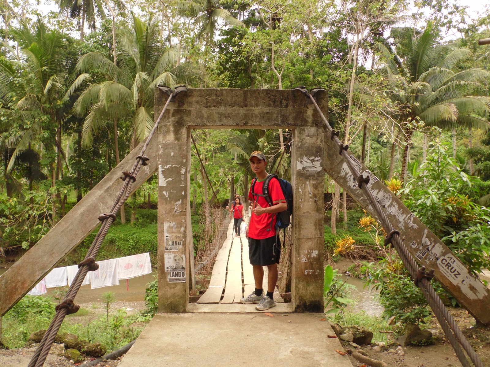
To go to Barangay Pugaan, drop by at Pala-o Market there is a Pugaan jeepney terminal there. Tell the driver of the Pugaan jeepney  to drop you off at the hanging bridge to Mt. Agad-Agad. They are familiar to it because it is very well known there . As for me, I rode a jeepney from the terminal and drop somewhere at the city which I don’t have an idea where I was.  I kept on asking for directions for Pala-o market and they say “just straight ahead”. Later did I found out that I was walking from Iligan Central Market to Pala-o wet market. While in Pala-o market, I ask some people there how far is the Pugaan terminal to the drop off point in the hanging bridge and they say it’s still far. When I asked how much is the fare; it’s only minimum. So I was thinking, if the fare is minimum then it would not be far enough. So I decided to just hike up to the drop off point. So that means, I hiked my way  from Iligan central market all the way to the peak of Mt. Agad-Agad.


the hanging bridge at the drop point in pugaan


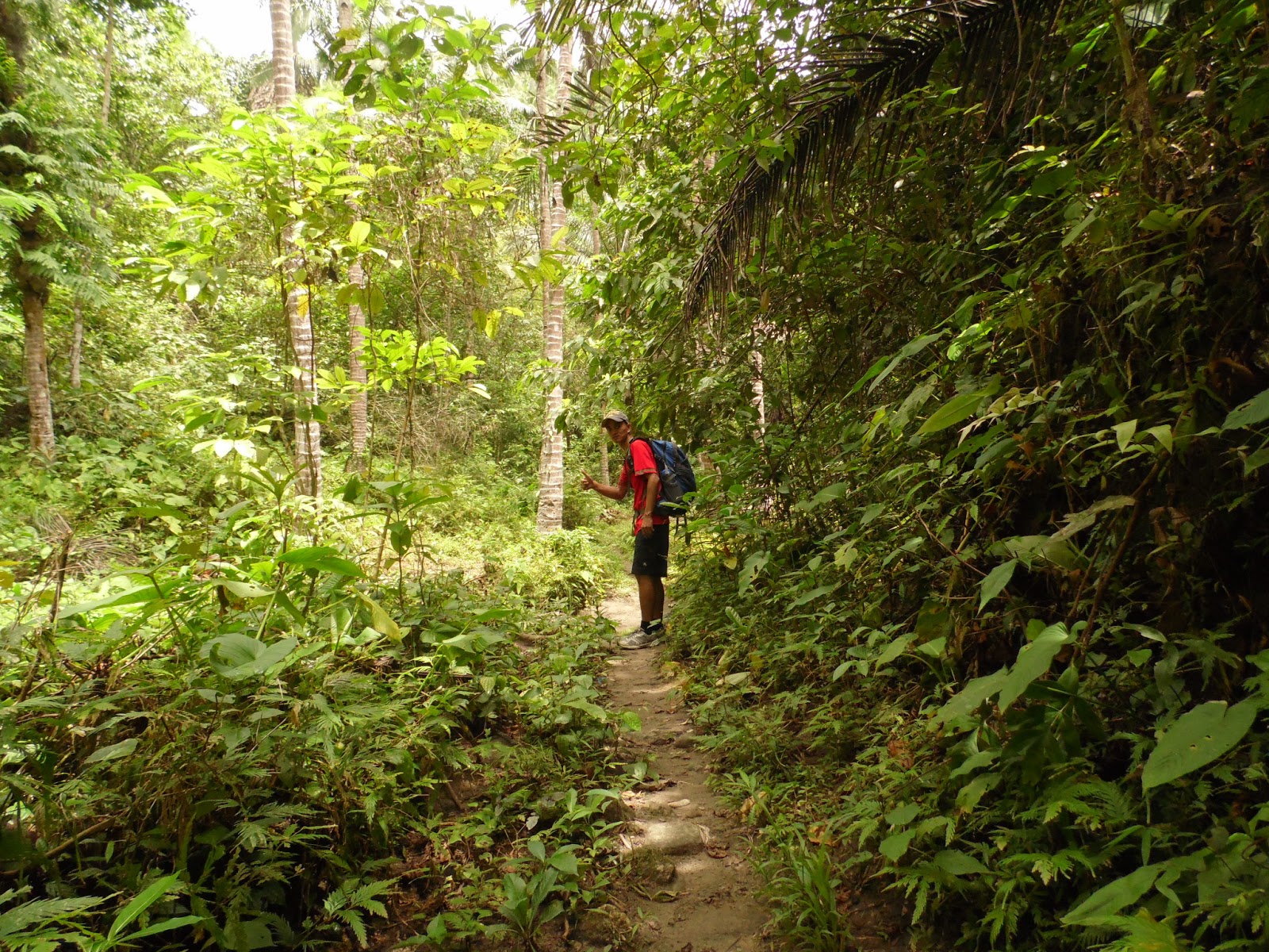
        The trail from the base is good. There is dense vegetation. It’s like in a rainforest. I can hear the birds chirping and there is a stream on the side that follows the trail. I passed by a mini waterfall but I think it is not accessible so I didn’t care to stop and go there. I just continued my way through. I also passed by  fishponds  


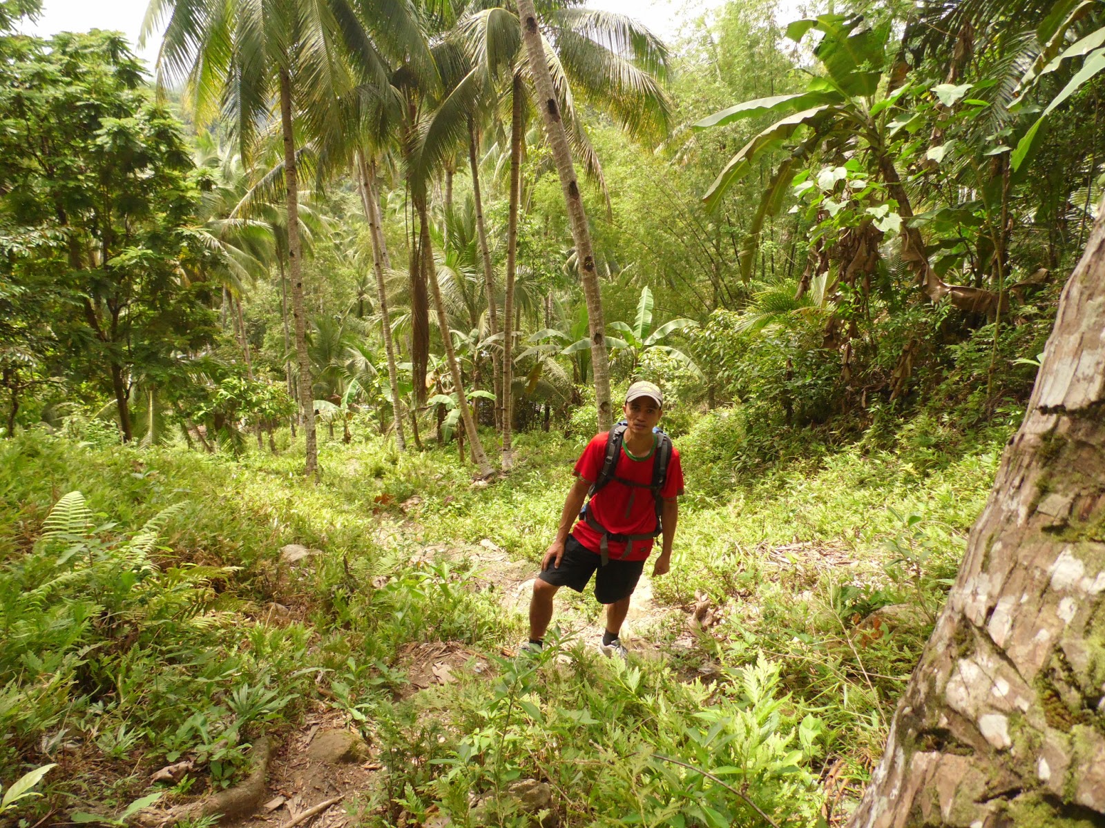
The start of the steep slope trail and I was taking pictures thinking that the steep slope would not last long and there would be no time for me to take pictures, only to find out that it was only the beginning. I quoted this mountain as “small but terrible” because of the long steep slope. I did not expect that it would be this hard. I thought it was just a simple walk. Indeed the line is true ‘never under estimate a mountain’ and it proved to me on this day.


            I kept on looking at the city trying to look at the view so that I’ll know how far I am from the peak  like what I have seen on the photos of the people who have already been here.

           I was going fast because I don’t know how long this will take. This is only a day hike. I  have to go home that same day. That includes the almost 2 hrs of travel by bus.
          I was gasping for air. The slope here is long unlike from the mountains that I have been which is only gradual. Inclinations could reach 70-85 degrees and usually takes 1hr and 30 min for an average hiker to reach the peak.


    I took a rest at one of the steepest slope of the trail desperately gasping for air. This is the "terrible" part. One thing I like about the trail is that the shade is at maximum. Caution though because both sides of the trail are cliffs which might lead to an accident or fall.


          I could almost see the entire view and that indicates I am already near the peak
After taking this picture, I took a long rest because I was so tired and gasping for air. I sat on the side of the trail thinking how long will this trail end. Only to find out that it was only a few steps and it was the peak and I laughed at myself for taking that long rest not knowing that I am very near on the peak to make a good rest.

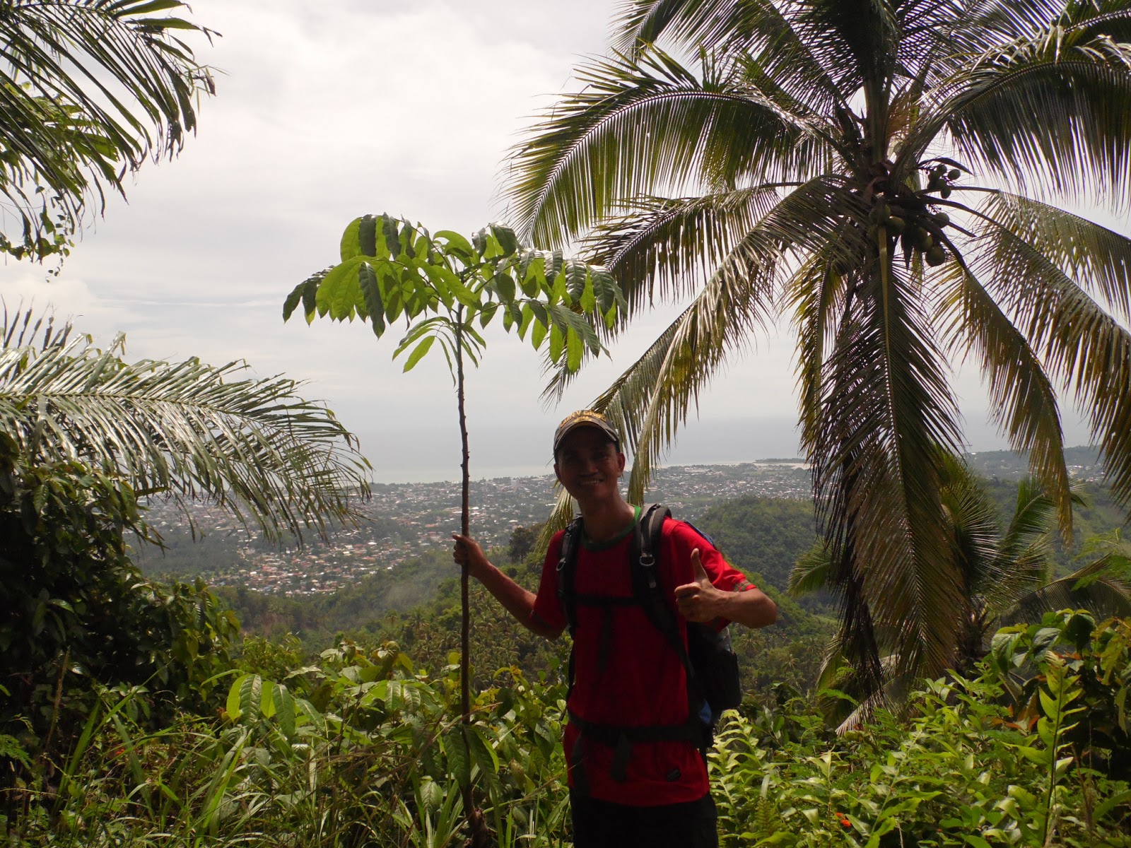
At the peak i am happy to see that there is a good camping site. The entire camping area is being fenced by a caretaker there trying to avoid intruders especially during night camps. They say the view of the city light at night is spectacular and also the sunrise and sunset. I was thinking for a night camp here maybe at some other time and experience it myself.


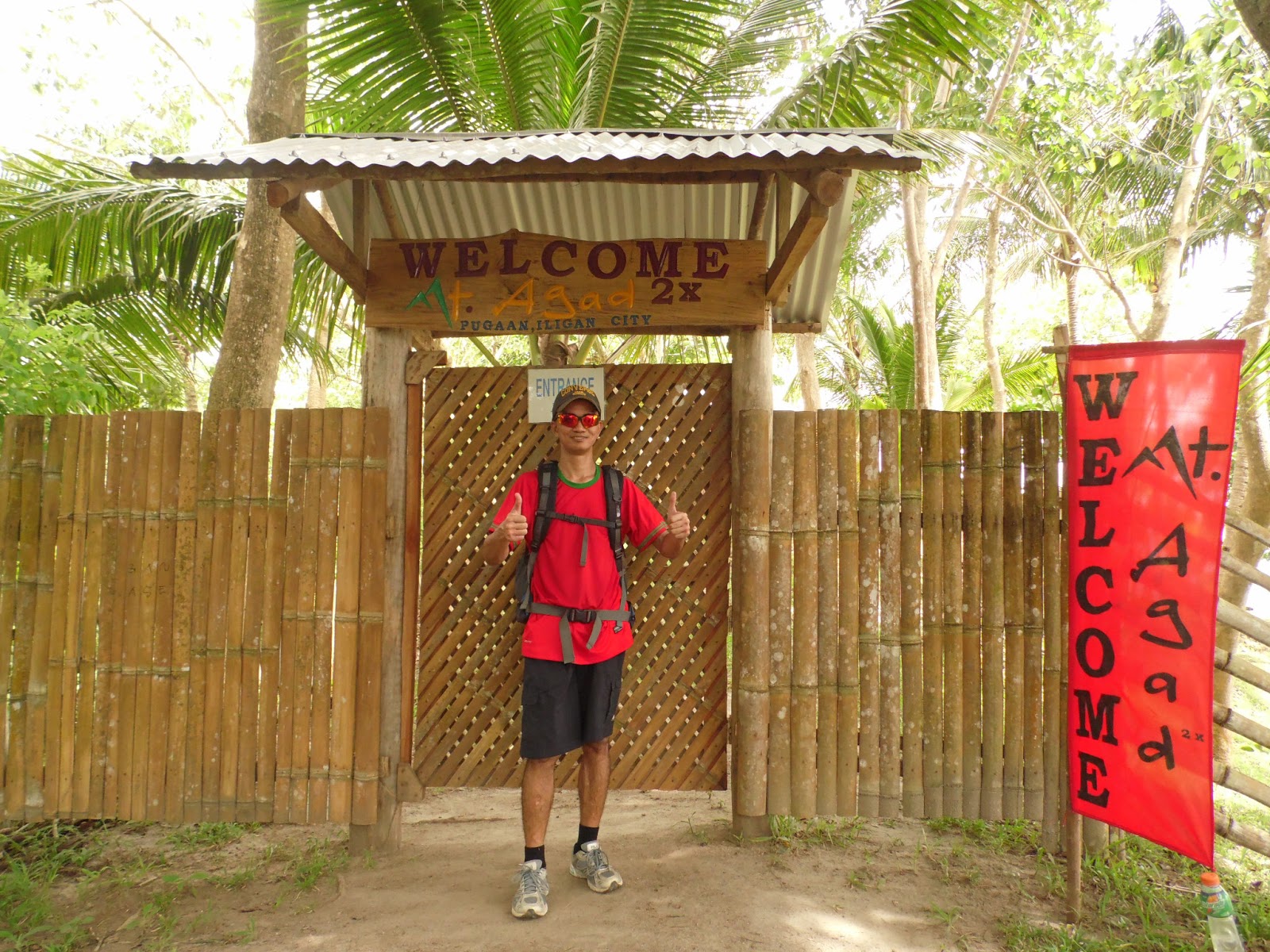
at the gate of the campsite 


  some pictures at the campsite:


there are benches to make the climbers relax


i could see the whole of Iligan bay area and the city proper

 jump shot

after taking pictures at the campsite i proceeded to the other peaks.


the communications tower at one of the peaks there


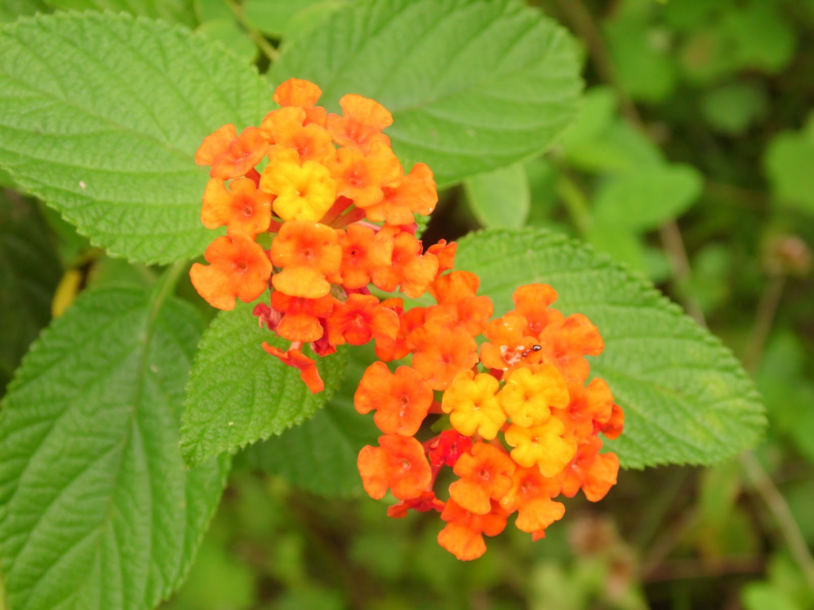
while going to the some other peaks i saw some multicolored flowers which my sister use to grow in pots or for landscaping. it is good to see them in the wild looking very healthy.


on my way to the other peaks


The main course here is only in the first peak where it is facing the city's bay area and you can see the entire city proper and as for the some other peaks, there are no such interesting sights or views.


After some short rest I immediately go for descend because the clouds are building up and there is a high possibility to rain so i wasted no time and hurried down.


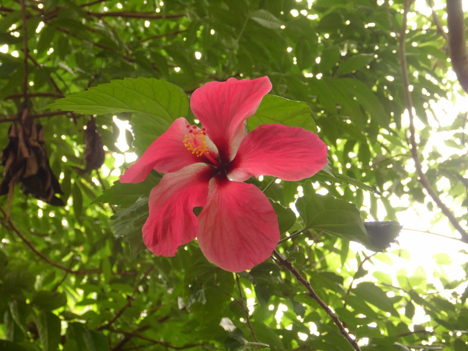
If the ascend is difficult in gasping air for the steep slopes, the descend is much worse. There is a big chance of getting a slip off on the trail because it is hard to walk on the trail facing the other way around. I almost slip my feet once. I saw some giant gumamela flowers which I didn't notice during the ascent.


I took time to go to the City Hall and take a picture at the Anahaw Amphitheater 
 A little rest and i'm on my way home
                                                         

 Getting there:

  • If you are riding a bus from Cagayan de Oro, drop by at the bus terminal and ride a jeepney going to pala-o wet market.
  • from pal-o wet market ask for the terminal of pugaan jeepney. Tell the driver to drop you off at the hanging bridge going to Mt. Agad- Agad. Upon reaching the Hanging bridge, there are locals there to ask about the directions.


                                       What to Bring: 
  • enough water canteen.
  • jackets or raincoats
  • flashlights
  • a good pair of shoes with a good grip for the steep slopes 


Thursday, May 16, 2013

Mt. Palaopao : the way of the cross


It’s been days before my birthday and I was looking for a hike that somehow makes a meaningful sense for me to thank God and meditate. I heard about Mt. Palaopao, the new pilgrimage destination during holy week and decided to go there to pray and hope to God.
              Mt. Palaopao is located in Sumilao, Bukidnon. It was used as a burial ground during the 19th century but is now serves as a pilgrimage destination especially during holy week in Catholic tradition.  It stands 668 meters above sea level and it has a wide mountain range that has caves and rockwalls. It is in this ranges where Sumalsag, Basag, Paiyak and several other caves are located.


I dropped by Sumilao bus terminal and headed to the back of Sumilao public market


At the back of the market there are rice fields and trail leading towards the mountain


                                                                The alluring mountain awaits me


The two peaks at the left side is my destination


 Halfway through the rice fields and zooming my camera at high level, I can see the big white cross at the peak.It made me more excited.


At the end of the rice fields I was amazed to see that there is a deep canyon with the river below.


                 Using my camera I can see the hanging bridge from the top of the canyon


           The trail on the canyon has very steep sections where it gets slippery during rainy season.


                   the hanging bridge
.


                                           At the end of the bridge is Sitio Palaopao.


     After the bridge I have come across two trails, one that leads to left and to the right. There is a house nearby but there’s nobody home. There’s no one to ask. Relying on my instincts, I decided to go right.  I was always looking up at the peak and I noticed that I was going farther away from it. It was then I have a great feeling that I am lost. It was the wrong way.


I was walking on tall cogon grasses that covered the trail that I took. It was far enough when I saw an old woman to ask about the directions and told me that the trail is on the opposite side. So I went back and took the trail going to the left from thebridge.


The settlers in Sitio Palaopao have their own chapel, basketball court and gardens. They then directed me to the trail.


And then I arrived at the chapel and took the trail at the back heading towards the mountain. I was looking for a bamboo cross to which they say that will lead me to the right trail.


                                                   I saw the first cross at the back of the chapel

      As I was going further, I was leading into more different trails. I couldn’t find any cross and the sad thing about it is that there is no one to ask. Again, I have to rely into my instincts. I took a trail and it led me to farms and houses.  And I got lost again. Going into farms after farms, which latter did I know that it was private property and I was trespassing.And then I met manong Eduardo Gorra and ask for directions. He then pointed me the way. As I was going to the direction he was pointing, he decided to go with me instead saying that he wants to go to the peak with me. He said that he could see people going in there on the trail but he has never been there. Manong Eduardo then came to be my guide and photographer. A good and kind hearted man.
                    The trail going up is very steep. It is very ‘technical’. The feeling of determination and excitement made me feel very invincible against the cruel heat and exhaustion for the trail going up has no means of shade.  Not good for first timers and weak at heart.  But for an average climber, it is very challenging.

It took us 45 minutes in reaching the cross at the first peak.


         The moment we reached the cross I was speechless. I was in awe. I was imagining the effort of the people in building that cross in the peak with all the heat and exhaustion that we’ve been through. I then knelt and prayed while manong Eduardo is just watching me. I talked to God and hoped.


With manong Eduardo Gorra


Watching the lowland from the peak is just amazing. We could almost see the whole lowland of Sumilao Bukidnon. I could see Mount Kitanglad on one side but it was covered with clouds.

After eating my lunch we then headed to the highest peak.

We passed by bushes which gives the only shelter there in the peak. And there were cliffs on either side.
 
We have to walk through sharp coral-like rocks in trail to the next peak


I was amazed to see that there is an old rugged cross at the next peak. It is made of tugas, a hard wood. Its rugged stature gives me an unexplainable feeling and made me teary eyed.
I knelt and sat at the cross for a while to rest. The moment lifted my weary spirit.


The first cross as viewed from the second peak.

After watching, talking about the lowlands and taking pictures at the peak, we then descended trying to get rid of getting caught of in a rain. Weather in this area is very unpredictable .Halfway through the trail, manong Eduardo part ways as he goes back to his hut and continues his chores there. I then continued the trail down to the base and saw the right trail that I doubted before.


Being on the right trail, I then got the chance to see the beautiful sides of the mountain. Like this rockwall


                             And several bamboo cross that I tried to find during my ascent


Before going up from the canyon, I took a moment to just stay and watch over at the bridge.
 I was fond of the hanging bridge.
It took the daredevil character in me. I was thinking, what if I could jump into the water in the river below. It would have been a great feeling to satisfy the pumping adrenalin in me. Nah, the river is shallow.
  

It took me 45 minutes to reach into the plains above the canyon and into the rice fields.

 I then took a final glance at the mountain that I have just been and I felt happy about my experience.
It is still 4:00 in the afternoon and I find ways to make the most of my time in Sumilao. So I decided to go to Alalum falls, just a kilometer away from the terminal.